
There is a local landmark where I live, Rucker’s tomb. It was built in 1907 to house the remains of the Rucker family. I thought it would be good practice and a perfect subject to create a 3D model using Agisoft metashape. I took 79 nadir and oblique photos of the tomb using a DJI mavic 2 pro. I also captured some pictures using my handheld sony camera. I used the photos from the handheld to capture some large scene pictures to help give metashape some context while aligning the photos in 3D space. I used a raw image format, set the camera to manual with autofocus, set the aperture to 5 to minimise field of view and adjusted to iso and shutter for nice clear images with minimal noise.
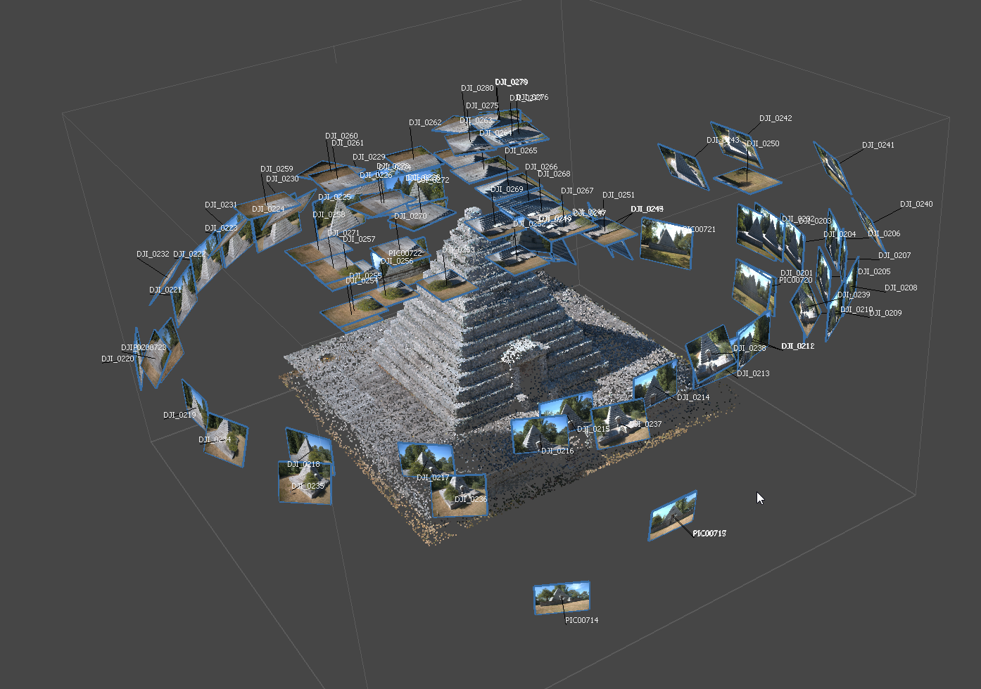
I added the pictures from the drone to a metashape project and ran the initial photo alignment and camera calibration. I then saved and loaded a new project file, added the photos from the sony handheld and ran photo align so that I can save a camera calibration file. I needed to have a separate calibration file for each camera I use in the original project. I then loaded up the project with the drone pictures, added the pictures from the sony and loaded the calibration file I made for it. I re-ran photo align and got a decent point clod out of it. I deleted all the tie points that were irrelevant, including the surrounding landscape and the trees that are planted in the corners of the base. I also spent a lot of time deleting points that were obviously noise. You tend to find a lot of noise around sharp edges but they are easy to spot and delete. This is what I was left with.
I then generated a dense point cloud and went through the same process of deleting noisy or unnecessary points. This is what I came up with.
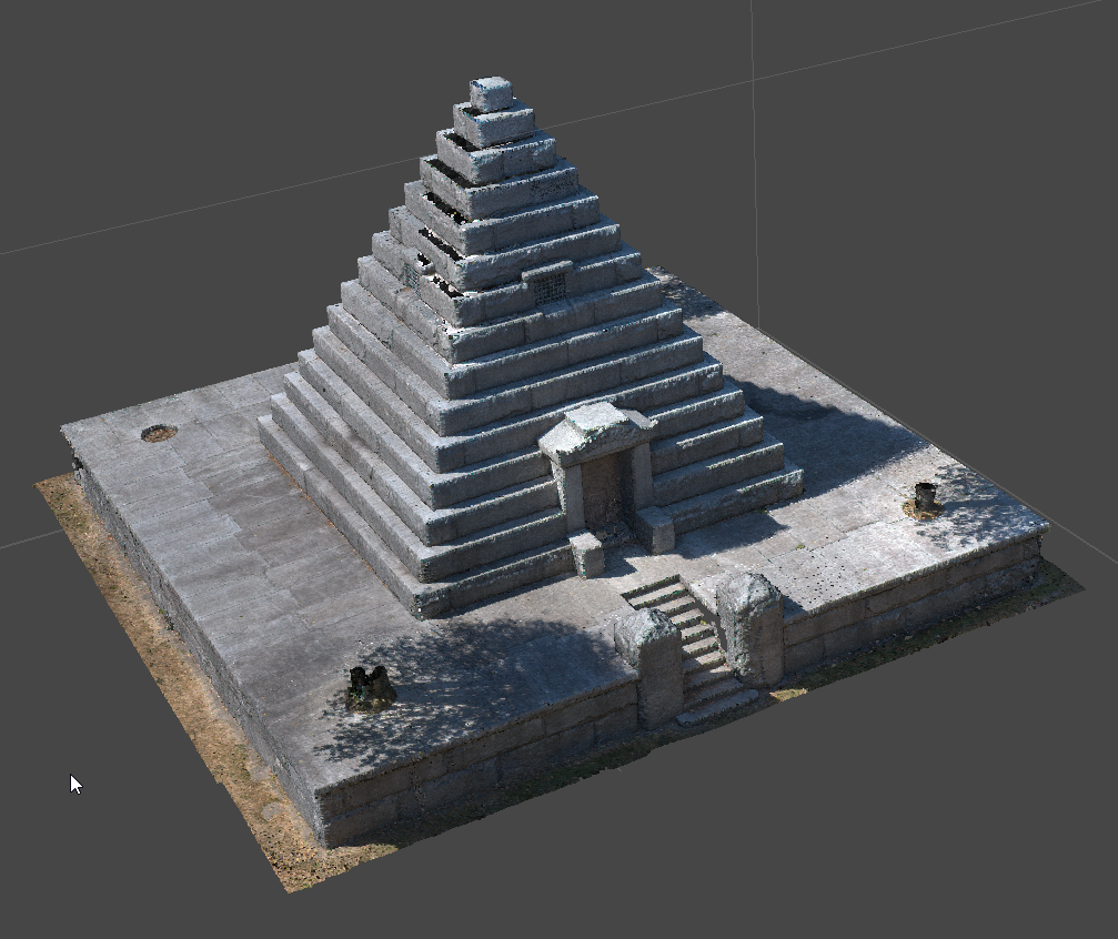
After that was done, I generated a mesh from the dense point cloud and ran the build texture algorithm. This is what i ended up with. The level of detail on it is simply amazing.


There are, however a few problems with the model, one large hole in the base caused by overgrowth. Meteshape has a hard time with brush and foliage as the chaotic nature of the images makes it hard to calculate tie points without a tremendous amount of noise, making it useless for modeling trees, bushes, etc. there is also some projection problems with the texture, caused by the surrounding trees.


I will show how I was able to correct these problems in my next blog post.
